We are nearing the end of this semesters GISjourney. I have mixed emotions about this, I have struggled many times during this semester but I feel like I have come out of this class with much more skill than I did when I came into it. Sadly I will not be continuing my GISjourney at this moment because I will be graduating after this class. This does not mean that I will be giving up GISing, more like taking some well needed time off. This is the last official lab for this class before the final and I have honestly started to like the more and more. This weeks lab, while offering the usual headaches of learning something new in ArcMap, was enjoyable for me and only gave me slight trouble(when I didn't read the directions). The objective was for us to use georeferencing to manipulate polygons to match a raster image. After this we were also introduced to ArcScene, which is a way to project a 3-D image of data based upon the attribute data. The past 2 weeks are what I was looking forward to doing when I started to GIS. I am much more interested in the analysis and manipulation of data rather than creating maps, because I don't have the best creativity. Luckily, that isn't graded in this class!
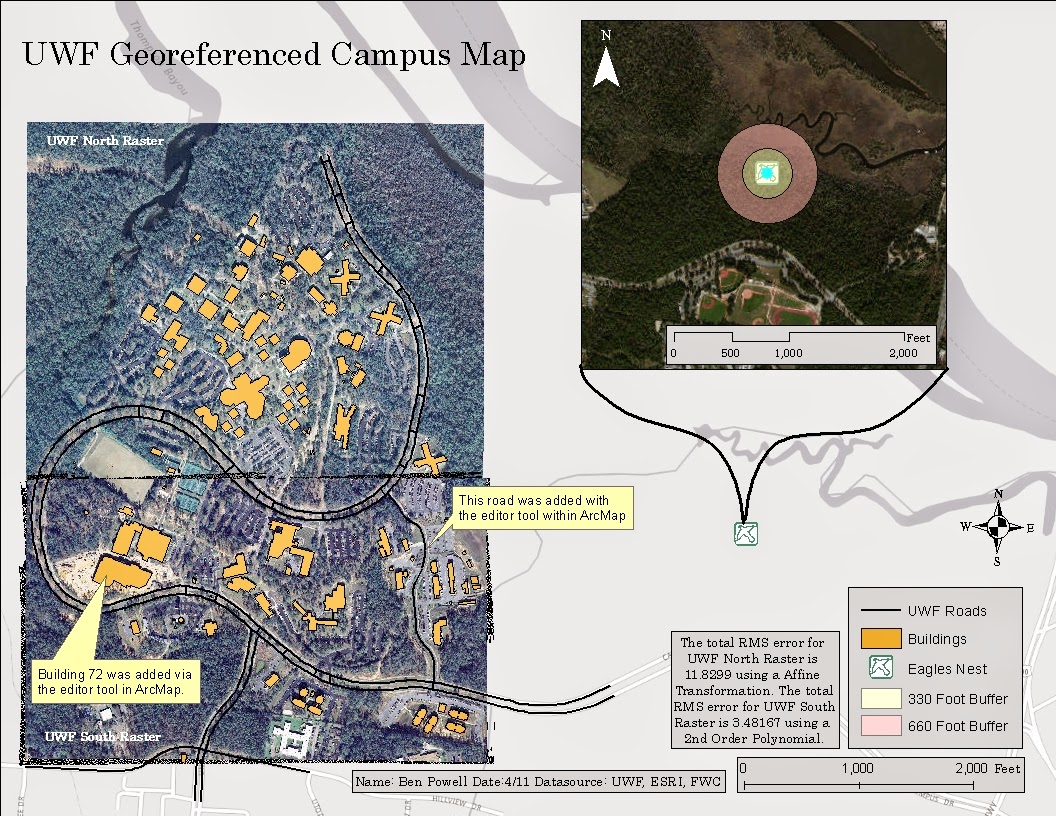 |
| UWF Georeferenced Campus Map |
This is my georeferenced and edited raster and shapefile image. I feel like this is one of my better maps that I have produced this semester, even if part of my neatline is cut off :) Below is a 3-D Digital Elevation Map created using ArcScene and ArcMap. ArcScene is very much like Google Earth in the navigation tools but offers much more capability. Well that's all for today GISers! See you for the Final!
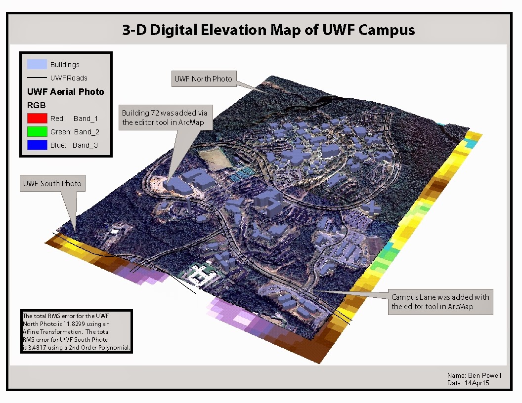 |
| 3d DEM |
No comments:
Post a Comment